
Manassas, Georgia
(Redirected from Manassas, GA)
Manassas, Georgia | |
|---|---|
 Location in Tattnall County and the state of Georgia | |
| Coordinates: 32°9′51″N 82°1′17″W / 32.16417°N 82.02139°W | |
| Country | United States |
| State | Georgia |
| County | Tattnall |
| Area | |
| • Total | 0.78 sq mi (2.01 km2) |
| • Land | 0.77 sq mi (2.00 km2) |
| • Water | 0.00 sq mi (0.01 km2) |
| Elevation | 210 ft (64 m) |
| Population (2020) | |
| • Total | 59 |
| • Density | 76.33/sq mi (29.48/km2) |
| Time zone | UTC-5 (Eastern (EST)) |
| • Summer (DST) | UTC-4 (EDT) |
| ZIP code | 30438 |
| Area code | 912 |
| FIPS code | 13-49504[2] |
| GNIS feature ID | 0332310[3] |
Manassas is a city in Tattnall County, Georgia, United States. Per the 2020 census, the population was 59.[4]
History[edit]
The community was named after Manassas Foy, the son of a local citizen.[5] The Georgia General Assembly incorporated Manassas as a city in 1920.[6]
Geography[edit]
Manassas is located at 32°9′51″N 82°1′17″W / 32.16417°N 82.02139°W (32.164091, -82.021337).[7]
According to the United States Census Bureau, the city has a total area of 0.8 square miles (2.1 km2), all of it land.
Demographics[edit]
| Census | Pop. | Note | %± |
|---|---|---|---|
| 1930 | 197 | — | |
| 1940 | 165 | −16.2% | |
| 1950 | 128 | −22.4% | |
| 1960 | 154 | 20.3% | |
| 1970 | 144 | −6.5% | |
| 1980 | 116 | −19.4% | |
| 1990 | 123 | 6.0% | |
| 2000 | 100 | −18.7% | |
| 2010 | 94 | −6.0% | |
| 2020 | 59 | −37.2% | |
| U.S. Decennial Census[8] 2010[9] 2020[10] | |||
| Race / Ethnicity | Pop 2010[9] | Pop 2020[10] | % 2010 | % 2020 |
|---|---|---|---|---|
| White alone (NH) | 46 | 36 | 48.94% | 61.02% |
| Black or African American alone (NH) | 36 | 23 | 38.30% | 38.98% |
| Native American or Alaska Native alone (NH) | 0 | 0 | 0.00% | 0.00% |
| Asian alone (NH) | 0 | 0 | 0.00% | 0.00% |
| Pacific Islander alone (NH) | 0 | 0 | 0.00% | 0.00% |
| Some Other Race alone (NH) | 0 | 0 | 0.00% | 0.00% |
| Mixed Race/Multi-Racial (NH) | 1 | 0 | 1.06% | 0.00% |
| Hispanic or Latino (any race) | 11 | 0 | 11.70% | 0.00% |
| Total | 94 | 59 | 100.00% | 100.00% |
In 2020, its population was 59, down from 94 in 2010 and 100 in 2000.
References[edit]
- ^ "2020 U.S. Gazetteer Files". United States Census Bureau. Retrieved December 18, 2021.
- ^ "U.S. Census website". United States Census Bureau. Retrieved January 31, 2008.
- ^ "US Board on Geographic Names". United States Geological Survey. October 25, 2007. Retrieved January 31, 2008.
- ^ "Manassas city, Georgia". United States Census Bureau. Retrieved April 15, 2022.
- ^ Krakow, Kenneth K. (1975). Georgia Place-Names: Their History and Origins (PDF). Macon, GA: Winship Press. p. 143. ISBN 0-915430-00-2.
- ^ Acts and Resolutions of the General Assembly of the State of Georgia. Clark & Hines, State Printers. 1920. p. 1164.
- ^ "US Gazetteer files: 2010, 2000, and 1990". United States Census Bureau. February 12, 2011. Retrieved April 23, 2011.
- ^ "Decennial Census of Population and Housing by Decades". US Census Bureau.
- ^ a b "P2 HISPANIC OR LATINO, AND NOT HISPANIC OR LATINO BY RACE – 2010: DEC Redistricting Data (PL 94-171) – Manassas city, Georgia". United States Census Bureau.
- ^ a b "P2 HISPANIC OR LATINO, AND NOT HISPANIC OR LATINO BY RACE – 2020: DEC Redistricting Data (PL 94-171) – Manassas city, Georgia". United States Census Bureau.
Municipalities and communities of Tattnall County, Georgia, United States | ||
|---|---|---|
| Cities | 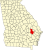 | |
| CDP | ||
| Unincorporated community | ||
| Ghost town | ||