
Gay, Georgia
Gay, Georgia | |
|---|---|
 Gay in 2013 | |
 Location in Meriwether County and the state of Georgia | |
| Coordinates: 33°5′38″N 84°34′26″W / 33.09389°N 84.57389°W | |
| Country | United States |
| State | Georgia |
| County | Meriwether |
| Government | |
| • Mayor | Christopher J. Walker[1] |
| Area | |
| • Total | 0.86 sq mi (2.24 km2) |
| • Land | 0.86 sq mi (2.24 km2) |
| • Water | 0.00 sq mi (0.00 km2) |
| Elevation | 840 ft (256 m) |
| Population | |
| • Total | 110 |
| • Density | 127.31/sq mi (49.15/km2) |
| Time zone | UTC-5 (Eastern (EST)) |
| • Summer (DST) | UTC-4 (EDT) |
| ZIP code | 30218 |
| Area code | 706 |
| FIPS code | 13-32384[4] |
| GNIS feature ID | 0355988[5] |
| Website | gayga |
Gay is a town in Meriwether County, Georgia, United States. The population was 110 at the 2020 census.[3]
History[edit]
An early variant name was "Sasserville".[6] A post office called Gay has been in operation since 1886.[7] The present name is after William F. Gay, an early postmaster.[8] The Georgia General Assembly incorporated the Town of Gay in 1907.[9]
Geography[edit]
Gay is located in northeastern Meriwether County at 33°5′38″N 84°34′26″W / 33.09389°N 84.57389°W (33.093797, −84.573924).[10] State Routes 74 and 85 run concurrently through the town, leading north 16 miles (26 km) to Senoia and south 8 miles (13 km) to Woodbury. State Route 109 Spur leads southwest from Gay 9 miles (14 km) to Greenville, the Meriwether county seat.
According to the United States Census Bureau, the town has a total area of 0.9 square miles (2.3 km2), of which 0.001 square miles (0.6 acres), or 0.12%, are water.[2] The Flint River passes 3 miles (5 km) to the east of the town.
Demographics[edit]
| Census | Pop. | Note | %± |
|---|---|---|---|
| 1910 | 210 | — | |
| 1920 | 290 | 38.1% | |
| 1930 | 251 | −13.4% | |
| 1940 | 262 | 4.4% | |
| 1950 | 241 | −8.0% | |
| 1960 | 194 | −19.5% | |
| 1970 | 200 | 3.1% | |
| 1980 | 175 | −12.5% | |
| 1990 | 133 | −24.0% | |
| 2000 | 149 | 12.0% | |
| 2010 | 89 | −40.3% | |
| 2020 | 110 | 23.6% | |
| U.S. Decennial Census[11] | |||
As of the census[4] of 2000, there were 149 people, 61 households, and 38 families residing in the town. The population density was 173.1 inhabitants per square mile (66.8/km2). There were 69 housing units at an average density of 80.2 per square mile (31.0/km2). The racial makeup of the town was 56.38% White and 43.62% African American.
There were 61 households, out of which 9.8% had children under the age of 18 living with them, 42.6% were married couples living together, 16.4% had a female householder with no husband present, and 37.7% were non-families. 34.4% of all households were made up of individuals, and 13.1% had someone living alone who was 65 years of age or older. The average household size was 2.44 and the average family size was 3.24.
In the town, the population was spread out, with 16.8% under the age of 18, 7.4% from 18 to 24, 19.5% from 25 to 44, 32.2% from 45 to 64, and 24.2% who were 65 years of age or older. The median age was 48 years. For every 100 females, there were 91.0 males. For every 100 females age 18 and over, there were 85.1 males.
The median income for a household in the town was $26,667, and the median income for a family was $29,583. Males had a median income of $31,875 versus $26,250 for females. The per capita income for the town was $20,840. There were 12.0% of families and 25.5% of the population living below the poverty line, including 82.4% of under eighteens and 17.2% of those over 64.
Arts and culture[edit]
The town of Gay hosts a "Cotton Pickin' Fair" on the first weekend of every May and October.[12]
The town was featured in Season 2, Episode 1 of Queer Eye on Netflix.
References[edit]
- ^ Town of Gay. "Town Officials". Town of Gay, Georgia. Retrieved March 4, 2024.
- ^ a b "2022 U.S. Gazetteer Files: Georgia". United States Census Bureau. Retrieved January 26, 2023.
- ^ a b "P1. Race – Gay town, Georgia: 2020 DEC Redistricting Data (PL 94-171)". U.S. Census Bureau. Retrieved January 26, 2023.
- ^ a b "U.S. Census website". United States Census Bureau. Retrieved January 31, 2008.
- ^ "US Board on Geographic Names". United States Geological Survey. October 25, 2007. Retrieved January 31, 2008.
- ^ Krakow, Kenneth K. (1975). Georgia Place-Names: Their History and Origins (PDF). Macon, GA: Winship Press. p. 91. ISBN 0-915430-00-2.
- ^ "Meriwether County". Jim Forte Postal History. Retrieved October 4, 2014.
- ^ Moyer, Armond; Moyer, Winifred (1958). The origins of unusual place-names. Keystone Pub. Associates. p. 56.
- ^ Acts and Resolutions of the General Assembly of the State of Georgia. Clark & Hines, State Printers. 1907. p. 669.
- ^ "US Gazetteer files: 2010, 2000, and 1990". United States Census Bureau. February 12, 2011. Retrieved April 23, 2011.
- ^ "Census of Population and Housing". Census.gov. Retrieved June 4, 2015.
- ^ "The Cotton Pickin' Fair".
Municipalities and communities of Meriwether County, Georgia, United States | ||
|---|---|---|
| Cities | 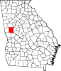 | |
| Towns | ||
| Unincorporated communities | ||
| Footnotes | ‡This populated place also has portions in an adjacent county or counties | |
| International | |
|---|---|
| National | |