
Heritage Range
| Heritage Range | |
|---|---|
 | |
| Dimensions | |
| Length | 160 km (99 mi)[1] |
| Width | 48 km (30 mi)[1] |
| Geography | |
 Heritage Range Location of Heritage Range in Antarctica | |
| Continent | Antarctica |
| Region | Ellsworth Land |
| Range coordinates | 79°45′S 83°00′W / 79.75°S 83°W[1] |
| Parent range | Ellsworth Mountains |
| Borders on | Sentinel Range |
The Heritage Range is a major mountain range, 160 km (99 mi) long and 48 km (30 mi) wide, situated southward of Minnesota Glacier and forming the southern half of the Ellsworth Mountains in Antarctica. The range is complex, consisting of scattered ridges and peaks of moderate height, escarpments, hills and nunataks, with the various units of relief set off by numerous intervening glaciers.[1]
The northern portion of the range was probably first sighted by Lincoln Ellsworth in the course of his trans-Antarctic flight of November 23, 1935. On December 14, 1959, the southern range was seen for the first time in a reconnaissance flight from Byrd Station, made by Edward C. Thiel, J. C. Craddock and E. S. Robinson. The team landed at a glacier on Pipe Peak, in the northwestern part of the range, on December 26.[1][2]
During the 1962–63 and 1963–64 seasons, the University of Minnesota expeditions made geologic and cartographic surveys of the range. The entire range was mapped by USGS from aerial photographs taken by the U.S. Navy, 1961–66.[1]
The Heritage range was so named by US-ACAN because topographic units within the range have received names relating to the theme of American heritage.[1]
Maps[edit]
- Union Glacier. Scale 1:250 000 topographic map. Reston, Virginia: US Geological Survey, 1966.
- Liberty Hills. Scale 1:250 000 topographic map. Reston, Virginia: US Geological Survey, 1966.
- Antarctic Digital Database (ADD). Scale 1:250000 topographic map of Antarctica. Scientific Committee on Antarctic Research (SCAR). Since 1993, regularly updated.
-
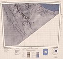
 Map of northern Heritage Range
 -
 Map of southern Heritage Range


Features[edit]
Geographical features include:
Anderson Massif[edit]
Douglas Peaks[edit]
Dunbar Ridge[edit]
Edson Hills[edit]
Enterprise Hills[edit]
Founders Peaks[edit]
Smith Ridge[edit]
Other Founders Peaks features[edit]
Frazier Ridge[edit]
Gifford Peaks[edit]
Independence Hills[edit]
Liberty Hills (Antarctica)[edit]
Meyer Hills[edit]
Pioneer Heights[edit]
Gross Hills[edit]
Inferno Ridge[edit]
Nimbus Hills[edit]
Samuel Nunataks[edit]
Other Nimbus Hills features[edit]
Other Pioneer Heights features[edit]
Soholt Peaks[edit]
Watlack Hills[edit]
Webers Peaks[edit]
Other features[edit]
- Barrett Nunataks
- Bingham Peak
- Cagle Peaks
- Carnell Peak
- Charles Peak
- Cunningham Peak
- Dott Ice Rise
- Driscoll Glacier
- Dybvadskog Peak
- Founders Escarpment
- Fusco Nunatak
- Gould Spur
- Gowan Glacier
- Hall Peak
- Hercules Inlet
- Herrin Peak
- High Nunatak
- Hoinkes Peak
- Hutto Peak
- Landmark Peak
- Linder Peak
- Matney Peak
- Mhire Spur
- Minnesota Glacier
- Mount Bursik
- Mount Johns
- Mount Rodger
- Mount Twiss
- Mount Woollard
- Navigator Peak
- Planck Point
- Robinson Peak
- Rutford Ice Stream
- Schneider Glacier
- Thompson Nunataks
- Three Sails
- Unger Peak
- Weaver Nunataks
- White Escarpment
- Wilson Nunataks
- Zavis Peak
References[edit]
- ^ a b c d e f g "Heritage Range". Geographic Names Information System. United States Geological Survey, United States Department of the Interior. Retrieved 11 November 2004.
- ^ Gerald F. Webers, et al., Geology and Paleontology of the Ellsworth Mountains, West Antarctica (Geological Society of America, 1992), p. xi
External links[edit]
![]() Media related to Heritage Range at Wikimedia Commons
Media related to Heritage Range at Wikimedia Commons

This Ellsworth Land location article is a stub. You can help Wikipedia by expanding it. |