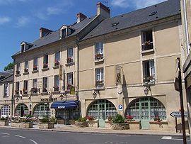
Creully
You can help expand this article with text translated from the corresponding article in French. (December 2008) Click [show] for important translation instructions.
|
Creully | |
|---|---|
Part of Creully sur Seulles | |
 | |
| Coordinates: 49°17′04″N 0°32′22″W / 49.2844°N 0.5394°W | |
| Country | France |
| Region | Normandy |
| Department | Calvados |
| Arrondissement | Caen |
| Canton | Thue et Mue |
| Commune | Creully sur Seulles |
| Area 1 | 8.56 km2 (3.31 sq mi) |
| Population (2018)[1] | 1,586 |
| • Density | 190/km2 (480/sq mi) |
| Time zone | UTC+01:00 (CET) |
| • Summer (DST) | UTC+02:00 (CEST) |
| Postal code | 14480 |
| Elevation | 7–61 m (23–200 ft) (avg. 40 m or 130 ft) |
| 1 French Land Register data, which excludes lakes, ponds, glaciers > 1 km2 (0.386 sq mi or 247 acres) and river estuaries. | |
Creully (French pronunciation: [kʁøli] ⓘ) is a former commune in the Calvados department in the Normandy region in northwestern France. On 1 January 2017, it was merged into the new commune Creully sur Seulles.[2]
The town square is named after Canadian Lieutenant Bill McCormick of the 1st Hussars Canadian Armoured Regiment (London, Ontario).[3] Lt. McCormick was the only Allied soldier to reach his D-Day objective when on 6 June 1944, after the tank he commanded passed through Creully, it reached the Caen-Bayeux road.[4]
Population[edit]
| Year | Pop. | ±% |
|---|---|---|
| 1962 | 692 | — |
| 1968 | 817 | +18.1% |
| 1975 | 692 | −15.3% |
| 1982 | 1,003 | +44.9% |
| 1990 | 1,396 | +39.2% |
| 1999 | 1,426 | +2.1% |
| 2008 | 1,569 | +10.0% |
See also[edit]
References[edit]
Wikimedia Commons has media related to Creully.
- ^ Téléchargement du fichier d'ensemble des populations légales en 2018, INSEE
- ^ Arrêté préfectoral 8 September 2016 (in French)
- ^ Outhit, Jeff (8 June 2011). "Liberator then, hero still". Record (Kitchener, ON). Retrieved 17 January 2021.
- ^ Belanger, Joe (8 June 2011). "Vet Wants to See Juno Beach Once More". Retrieved 17 January 2021.


