Cave City, Arkansas
Cave City, Arkansas | |
|---|---|
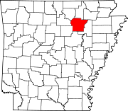
 Location of Cave City in Independence County and Sharp County, Arkansas. | |
| Coordinates: 35°56′53″N 91°33′3″W / 35.94806°N 91.55083°W | |
| Country | United States |
| State | Arkansas |
| Counties | Independence, Sharp |
| Townships | Barren (Independence) Cave (Sharp) |
| Settled | 1890 |
| Founded by | James Andrew Laman and John William Laman |
| Area | |
| • Total | 2.56 sq mi (6.62 km2) |
| • Land | 2.56 sq mi (6.62 km2) |
| • Water | 0.00 sq mi (0.00 km2) |
| Elevation | 653 ft (199 m) |
| Population (2020) | |
| • Total | 1,922 |
| • Density | 751.66/sq mi (290.23/km2) |
| Time zone | UTC-6 (Central (CST)) |
| • Summer (DST) | UTC-5 (CDT) |
| ZIP code | 72521 |
| Area code | 870 |
| FIPS code | 05-12280 |
| GNIS feature ID | 2404007[2] |
| Website | www |
Cave City is a city in Independence and Sharp counties in the U.S. state of Arkansas. The population was 1,904 at the 2010 census.[3] The city was named for a large cave underneath the Crystal River Tourist Camp, which is the oldest motor court in Arkansas.[4] Cave City is known for its award-winning "world's sweetest" watermelons and holds an annual watermelon festival in July.[5]
Geography[edit]
Cave City is located at 35°56′53″N 91°33′3″W / 35.94806°N 91.55083°W (35.948087, -91.550952).[6] The town is centered on, and partially located above, the Crystal River, an underground body of water located in the multi-room Crystal River Cave, for which the town is named. The beginning and ending of the water source has never been determined.
According to the United States Census Bureau, the city has a total area of 1.2 square miles (3.1 km2), all land.
List of highways[edit]
Demographics[edit]
| Census | Pop. | Note | %± |
|---|---|---|---|
| 1910 | 278 | — | |
| 1920 | 243 | −12.6% | |
| 1930 | 296 | 21.8% | |
| 1940 | 427 | 44.3% | |
| 1950 | 442 | 3.5% | |
| 1960 | 540 | 22.2% | |
| 1970 | 807 | 49.4% | |
| 1980 | 1,634 | 102.5% | |
| 1990 | 1,503 | −8.0% | |
| 2000 | 1,946 | 29.5% | |
| 2010 | 1,904 | −2.2% | |
| 2020 | 1,922 | 0.9% | |
| U.S. Decennial Census[7] 2014 Estimate[8] | |||
2020 census[edit]
| Race | Number | Percentage |
|---|---|---|
| White (non-Hispanic) | 1,711 | 89.02% |
| Black or African American (non-Hispanic) | 53 | 2.76% |
| Native American | 16 | 0.83% |
| Asian | 8 | 0.42% |
| Other/Mixed | 81 | 4.21% |
| Hispanic or Latino | 53 | 2.76% |
As of the 2020 United States census, there were 1,922 people, 853 households, and 554 families residing in the city.
2000 census[edit]
At the 2000 census there were 1,904 people in 751 households, including 504 families, in the city. The population density was 752.7 inhabitants per square mile (290.6/km2). There were 838 housing units at an average density of 326.1 per square mile (125.9/km2). The racial makeup of the city was 0.3% Black, 96.9% white or European, 0.1% Asian, and 1.5% from two or more races. 2.5% of the population were Hispanic or Latino of any race.[10]

Of the 751 households 34.8% had children under the age of 18 living with them, 49% were married couples living together, 14.5% had a female householder with no husband present, and 32.9% were non-families. 29.6% of households were one person and 14.7% were one person aged 65 or older. The average household size was 2.45 and the average family size was 3.01.
The age distribution was 31.1% under the age of 18, 5.4% from 19 to 24, 24.9% from 25 to 44, 20.8% from 45 to 64, and 18% 65 or older. The median age was 35.8 years. For every 100 females, there were 79.9 males. 31.4% of the male population and 40.3% of females were 18 and over.
The median household income was $23,163 and the median family income was $27,292. Males had a median income of $21,397 versus $17,424 for females. The per capita income for the city was $11,925. About 17.0% of families and 21.3% of the population were below the poverty line, including 26.3% of those under age 18 and 15.6% of those age 65 or over.
Education[edit]
Students in the area can attend the Cave City School District.
References[edit]
- ^ "2020 U.S. Gazetteer Files". United States Census Bureau. Retrieved October 29, 2021.
- ^ a b U.S. Geological Survey Geographic Names Information System: Cave City, Arkansas
- ^ "Profile of General Population and Housing Characteristics: 2010 Demographic Profile Data (DP-1): Cave City city, Arkansas". United States Census Bureau. Retrieved August 10, 2012.
- ^ "Cave Courts Motel - The Oldest Motor Court in Arkansas". American Profile. December 23, 2000. Retrieved August 28, 2011.
- ^ DeLano, Patti (2005). Off the Beaten Path, Arkansas (9th ed.). Guilford, Connecticut: Morris Book Publishing. ISBN 978-0-7627-4856-3. ISSN 1537-0550.
- ^ "US Gazetteer files: 2020, 2010, and 2000". United States Census Bureau. February 12, 2011. Retrieved April 23, 2011.
- ^ "Census of Population and Housing". Census.gov. Retrieved June 4, 2015.
- ^ "Annual Estimates of the Resident Population for Incorporated Places: April 1, 2010 to July 1, 2014". Archived from the original on May 22, 2015. Retrieved June 4, 2015.
- ^ "Explore Census Data". data.census.gov. Retrieved December 30, 2021.
- ^ "U.S. Census website". United States Census Bureau. Retrieved January 31, 2008.


