
Tuckahoe, New Jersey
Tuckahoe, New Jersey | |
|---|---|
 Tuckahoe station, built in 1884 in Tuckahoe | |
 Tuckahoe Location in Cape May County  Tuckahoe Location in New Jersey  Tuckahoe Location in the United States | |
| Coordinates: 39°17′24″N 74°45′14″W / 39.29000°N 74.75389°W | |
| Country | |
| State | |
| County | Cape May |
| Township | Upper |
| Area | |
| • Total | 1.04 sq mi (2.70 km2) |
| • Land | 1.04 sq mi (2.70 km2) |
| • Water | 0.00 sq mi (0.00 km2) |
| Population | |
| • Total | 357 |
| • Density | 342.28/sq mi (132.21/km2) |
| Time zone | UTC−05:00 (Eastern (EST)) |
| • Summer (DST) | UTC−04:00 (Eastern (EDT)) |
| ZIP Codes | 08250 |
| Area code | 609 |
| FIPS code | 34-74180[3] |
Tuckahoe is a census-designated place (CDP)[4] unincorporated community located within Upper Township in Cape May County of New Jersey.[5]
| Census | Pop. | Note | %± |
|---|---|---|---|
| 2020 | 357 | — | |
| U.S. Decennial Census[6] | |||
History[edit]
The tuckahoe plant was pounded into pulp by local Native Americans and used for cooking and baking, as flour, which served as an ingredient in their cornbread.
Since the tuckahoe was found in great abundance in this area, members of various Lenape tribes would visit this location to collect them.
A bridge, constructed in 1926 and renovated in 1961, connects Tuckahoe to Corbin City, its neighbor to the north.[7] It is also the headquarters for the Cape May Seashore Lines Railroad.
Tuckahoe is named after the wild tuckahoe, which is the sclerotium of the fungus Wolfiporia extensa and sometimes also called Indian Bread, which grew in abundance in this area on the roots of certain trees and was collected by the members of the Lenape tribes in the area.
Roads[edit]
Tuckahoe Road, which has its beginnings in Cross Keys, New Jersey at Route 42, provides access to Ocean City at the northern edge of Cape May County and other shore points as an alternative route to the Atlantic City Expressway.
Education[edit]
As with other parts of Upper Township, the area is zoned to Upper Township School District (for grades K-8), which sends students to Ocean City High School for grades 9-12.
Countywide schools include Cape May County Technical High School and Cape May County Special Services School District.
See also[edit]
References[edit]
- ^ "ArcGIS REST Services Directory". United States Census Bureau. Retrieved October 11, 2022.
- ^ "Census Population API". United States Census Bureau. Retrieved October 11, 2022.
- ^ Geographic Codes Lookup for New Jersey, Missouri Census Data Center. Accessed June 9, 2023.
- ^ State of New Jersey Census Designated Places - BVP20 - Data as of January 1, 2020, United States Census Bureau. Accessed December 1, 2022.
- ^ Locality Search, State of New Jersey. Accessed June 9, 2016.
- ^ "Census of Population and Housing". Census.gov. Retrieved June 4, 2016.
- ^ Historic American Engineering Record (HAER) No. NJ-89, "State Route 50 Bascule Bridge"
External links[edit]
Municipalities and communities of Cape May County, New Jersey, United States | ||
|---|---|---|
| Cities | 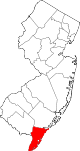 | |
| Boroughs | ||
| Townships | ||
| CDPs | ||
| Other communities | ||