
Mei Foo station
This article needs additional citations for verification. (September 2011) |
Mei Foo 美孚 | |||||||||||||||||||||||||||||||||||||||||||||||||||||
|---|---|---|---|---|---|---|---|---|---|---|---|---|---|---|---|---|---|---|---|---|---|---|---|---|---|---|---|---|---|---|---|---|---|---|---|---|---|---|---|---|---|---|---|---|---|---|---|---|---|---|---|---|---|
.JPG) Station exterior (Tuen Ma line building near exit G) | |||||||||||||||||||||||||||||||||||||||||||||||||||||
| Chinese name | |||||||||||||||||||||||||||||||||||||||||||||||||||||
| Chinese | 美孚 | ||||||||||||||||||||||||||||||||||||||||||||||||||||
| Cantonese Yale | Méih fū | ||||||||||||||||||||||||||||||||||||||||||||||||||||
| Literal meaning | Mobil | ||||||||||||||||||||||||||||||||||||||||||||||||||||
| |||||||||||||||||||||||||||||||||||||||||||||||||||||
| General information | |||||||||||||||||||||||||||||||||||||||||||||||||||||
| Location | Tsuen Wan line : Mount Sterling, Mei Foo Sun Chuen, Lai Chi Kok, Tuen Ma line : Lai Chi Kok Park, Lai Chi Kok, Sham Shui Po District Hong Kong | ||||||||||||||||||||||||||||||||||||||||||||||||||||
| Coordinates | 22°20′17″N 114°08′15″E / 22.3381°N 114.1376°E | ||||||||||||||||||||||||||||||||||||||||||||||||||||
| Owned by | |||||||||||||||||||||||||||||||||||||||||||||||||||||
| Operated by | MTR Corporation | ||||||||||||||||||||||||||||||||||||||||||||||||||||
| Line(s) |
| ||||||||||||||||||||||||||||||||||||||||||||||||||||
| Platforms | |||||||||||||||||||||||||||||||||||||||||||||||||||||
| Tracks | 4 | ||||||||||||||||||||||||||||||||||||||||||||||||||||
| Connections | |||||||||||||||||||||||||||||||||||||||||||||||||||||
| Construction | |||||||||||||||||||||||||||||||||||||||||||||||||||||
| Structure type |
| ||||||||||||||||||||||||||||||||||||||||||||||||||||
| Accessible | Yes | ||||||||||||||||||||||||||||||||||||||||||||||||||||
| Architect | Mass Transit Railway Corporation (Tsuen Wan Line station) Aedas (then known as Liang Peddle Thorp Architects & Planners) and Hong Kong Government city planners (West Rail/Tuen Ma Line station) | ||||||||||||||||||||||||||||||||||||||||||||||||||||
| Other information | |||||||||||||||||||||||||||||||||||||||||||||||||||||
| Station code | MEF | ||||||||||||||||||||||||||||||||||||||||||||||||||||
| History | |||||||||||||||||||||||||||||||||||||||||||||||||||||
| Opened |
| ||||||||||||||||||||||||||||||||||||||||||||||||||||
| Electrified |
| ||||||||||||||||||||||||||||||||||||||||||||||||||||
| Previous names | Lai Wan | ||||||||||||||||||||||||||||||||||||||||||||||||||||
| Services | |||||||||||||||||||||||||||||||||||||||||||||||||||||
| |||||||||||||||||||||||||||||||||||||||||||||||||||||
| |||||||||||||||||||||||||||||||||||||||||||||||||||||
| Location | |||||||||||||||||||||||||||||||||||||||||||||||||||||
 Mei Foo Location within the MTR system | |||||||||||||||||||||||||||||||||||||||||||||||||||||
| Mei Foo station | |||||||||||||
|---|---|---|---|---|---|---|---|---|---|---|---|---|---|
| Former name (1982-1985) | |||||||||||||
| Traditional Chinese | 荔灣 | ||||||||||||
| Simplified Chinese | 荔湾 | ||||||||||||
| Literal meaning | Lychee bay | ||||||||||||
| |||||||||||||
Mei Foo (Chinese: 美孚) is a Hong Kong MTR station located in Mei Foo Sun Chuen, Lai Chi Kok, New Kowloon. It is the only interchange station between the Tsuen Wan line and the Tuen Ma line, situated between Lai Chi Kok and Lai King stations on the Tsuen Wan line and Nam Cheong and Tsuen Wan West stations on the Tuen Ma line. Mei Foo station's colour is blue.
The Tsuen Wan line part of the station is a simple through station with a central island platform, located under Mount Sterling Mall, a pedestrian-only street between the rows of residential buildings in the Mei Foo Sun Chuen housing estate. The station is designed to facilitate transport needs of the residents of Mei Foo Sun Chuen housing estate, there are 132 buildings and several schools, and the point of transfer between the Kowloon urban area and the new town of Tsuen Wan. If there is heavy traffic on the main road into urban Kowloon, the Kwai Chung Road, many commuters get off their buses and use this station as their link to Kowloon and Central on Hong Kong Island.
History[edit]
The station's original name was Lai Chi Kok during the planning stage, but upon its opening on 17 May 1982 the station was called "Lai Wan"[1] (荔灣, short for Lai Chi Kok Bay), and was renamed to its current name on 31 May 1985 when Island line opened.
The West Rail line (then known as KCR West Rail) part of the station was opened on 20 December 2003 along with the rail line. The station is located in the middle of Lai Chi Kok Park, slightly to the west of the Tsuen Wan line's part of the station. The scenery of the park was greatly destroyed during the construction of the station, but the park was subsequently rebuilt over the station complex. The Tsuen Wan line and West Rail line stations merged into one station on 2 December 2007 in the MTR–KCR merger.
On 27 June 2021, the West Rail line officially merged with the Ma On Shan line (which was already extended into the Tuen Ma line Phase 1 at the time) in East Kowloon to form the new Tuen Ma line, as part of the Shatin to Central link project. Hence, Mei Foo was included in the project and is now an intermediate station on the Tuen Ma line.
Layout[edit]
Both Tsuen Wan line platforms share the same island platform. Unlike at Nam Cheong station (where there is one cross-platform interchange between the Tung Chung line and the Tuen Ma line), the Tsuen Wan line and Tuen Ma line platforms are considerably far apart. The concourses for these platforms are a five to ten-minute walk along a connecting passageway.
Although the Tuen Ma line platform is constructed at ground level, like Nam Cheong station, the station and surrounding track is sealed to avoid disturbance to the colocated park.
| R | roof garden | Exit G, Lai Chi Kok Park, footbridge to Ching Lai Court, Lai King Hill Road |
| C | Tuen Ma line concourse | Exit F, customer services, washrooms, shops, vending machines, automatic teller machines |
| P | side platform | |
| Platform 1 | Tuen Ma line towards Tuen Mun (Tsuen Wan West) → | |
| Platform 2 | ← Tuen Ma line towards Wu Kai Sha (Nam Cheong) | |
| side platform | ||
| G | passageway | Exit D, Lai Chi Kok Park |
| Tsuen Wan line concourse | Exits A, B, C, E | |
| L1 | subway | passageway connecting Tuen Ma line and Tsuen Wan line concourses |
| L2 | Tsuen Wan line concourse | customer service centre, shops, vending machine, automatic teller machines, Octopus promotion machine |
| L3 | Platform 1 | Tsuen Wan line towards Tsuen Wan (Lai King) → |
| island platform | ||
| Platform 2 | ← Tsuen Wan line towards Central (Lai Chi Kok) | |
-
 Tsuen Wan line concourse
 -
 Tsuen Wan line platform
 -
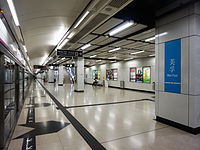 Tuen Ma line platform
 -
 Tuen Ma line concourse (when it was still part of the West Rail line)
 -
 Interchange passageway


Entrances/exits[edit]
- A: Broadway
- B: Mount Sterling Mall
- C1: Lai Wan Road
- C2: Humbert Street

- D: Lai Chi Kok Park (Lai Wan Road)
- E: Lai Wan Road
- F: Lai Chi Kok Park
- G: Lai King Hill Road[3]
-
 Exit A
 -
 Exit A
 -
 Exit G
 -
 Exit D
 -
 Exit D


.JPG)

References[edit]
- ^ Yu, Pui-kwan, Robin, "A study on quasi-public space in large scale private residential development, case in Hong Kong" Archived 22 March 2012 at the Wayback Machine, p. 28, University of Hong Kong, 2007
- ^ "Mei Foo Station layout" (PDF). MTR Corporation. Retrieved 30 July 2014.
- ^ "Mei Foo Station street map" (PDF). MTR Corporation. Retrieved 30 July 2014.