
Sparks, Georgia
Sparks, Georgia | |
|---|---|
 Sparks City Hall | |
 Location in Cook County and the state of Georgia | |
| Coordinates: 31°10′9″N 83°26′23″W / 31.16917°N 83.43972°W | |
| Country | United States |
| State | Georgia |
| County | Cook |
| Area | |
| • Total | 4.14 sq mi (10.72 km2) |
| • Land | 3.97 sq mi (10.27 km2) |
| • Water | 0.17 sq mi (0.45 km2) |
| Elevation | 240 ft (73 m) |
| Population (2020) | |
| • Total | 2,043 |
| • Density | 515.13/sq mi (198.90/km2) |
| Time zone | UTC-5 (Eastern (EST)) |
| • Summer (DST) | UTC-4 (EDT) |
| ZIP code | 31647[2] |
| Area code | 229 |
| FIPS code | 13-72556[3] |
| GNIS feature ID | 0333097[4] |
Sparks is a town in Cook County, Georgia, United States. The population was 2,052 at the 2010 census,[5] and 2,043 in 2020.[6]
History[edit]
A post office called Sparks was established in 1888.[7] The community was named after W.B. Sparks, the president of the Georgia Southern and Florida Railway.[8][9]
The Georgia General Assembly incorporated Sparks as a town in 1888.[10]
Geography[edit]
Sparks is located near the center of Cook County at 31°10′09″N 83°26′23″W / 31.169210°N 83.439757°W.[11] It is bordered on the south by the city of Adel, the county seat. U.S. Route 41 passes through the center of the town as Goodman Street. Interstate 75 runs through the west side of the town, with access from Exit 41. Tifton is 20 miles (32 km) to the north, and Valdosta is 26 miles (42 km) to the south.
According to the United States Census Bureau, Sparks has a total area of 4.1 square miles (10.7 km2), of which 3.9 square miles (10.1 km2) is land and 0.23 square miles (0.6 km2), or 5.64%, is water.[5]
Demographics[edit]
| Census | Pop. | Note | %± |
|---|---|---|---|
| 1890 | 307 | — | |
| 1900 | 683 | 122.5% | |
| 1910 | 842 | 23.3% | |
| 1920 | 792 | −5.9% | |
| 1930 | 635 | −19.8% | |
| 1940 | 695 | 9.4% | |
| 1950 | 887 | 27.6% | |
| 1960 | 1,158 | 30.6% | |
| 1970 | 1,337 | 15.5% | |
| 1980 | 1,353 | 1.2% | |
| 1990 | 1,205 | −10.9% | |
| 2000 | 1,755 | 45.6% | |
| 2010 | 2,052 | 16.9% | |
| 2020 | 2,043 | −0.4% | |
| U.S. Decennial Census[12] | |||
| Race | Num. | Perc. |
|---|---|---|
| White (non-Hispanic) | 634 | 31.03% |
| Black or African American (non-Hispanic) | 1,149 | 56.24% |
| Native American | 2 | 0.1% |
| Asian | 3 | 0.15% |
| Pacific Islander | 1 | 0.05% |
| Other/Mixed | 60 | 2.94% |
| Hispanic or Latino | 194 | 9.5% |
As of the 2020 United States census, there were 2,043 people, 778 households, and 572 families residing in the town.
References[edit]
- ^ "2020 U.S. Gazetteer Files". United States Census Bureau. Retrieved December 18, 2021.
- ^ United States Postal Service (2012). "USPS - Look Up a ZIP Code". Retrieved February 15, 2012.
- ^ "U.S. Census website". United States Census Bureau. Retrieved January 31, 2008.
- ^ "US Board on Geographic Names". United States Geological Survey. October 25, 2007. Retrieved January 31, 2008.
- ^ a b "Geographic Identifiers: 2010 Demographic Profile Data (G001): Sparks town, Georgia". U.S. Census Bureau, American Factfinder. Archived from the original on February 12, 2020. Retrieved July 30, 2014.
- ^ a b "Explore Census Data". data.census.gov. Retrieved December 18, 2021.
- ^ "Post Offices". Jim Forte Postal History. Retrieved June 10, 2019.
- ^ Krakow, Kenneth K. (1975). Georgia Place-Names: Their History and Origins (PDF). Macon, GA: Winship Press. p. 210. ISBN 0-915430-00-2.
- ^ Huffard, R. Scott (2019). Engines of Redemption: Railroads and the Reconstruction of Capitalism in the New South. Chapel Hill: University of North Carolina Press. p. 57.
- ^ "About Us". Adel-Cook County Chamber of Commerce. Archived from the original on March 7, 2018. Retrieved June 11, 2019.
- ^ "US Gazetteer files: 2010, 2000, and 1990". United States Census Bureau. February 12, 2011. Retrieved April 23, 2011.
- ^ "Census of Population and Housing". Census.gov. Retrieved June 4, 2015.
Municipalities and communities of Cook County, Georgia, United States | ||
|---|---|---|
| City | 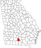 | |
| Towns | ||
| Unincorporated community | ||