
Cove, Oregon
Cove, Oregon | |
|---|---|
 Cove Library | |
 Location in Oregon | |
| Coordinates: 45°17′47″N 117°48′37″W / 45.29639°N 117.81028°W | |
| Country | United States |
| State | Oregon |
| County | Union |
| Incorporated | 1904 |
| Government | |
| • Mayor | Sherry Haeger[citation needed] |
| Area | |
| • Total | 0.80 sq mi (2.08 km2) |
| • Land | 0.80 sq mi (2.08 km2) |
| • Water | 0.00 sq mi (0.00 km2) |
| Elevation | 2,914 ft (888 m) |
| Population | |
| • Total | 620 |
| • Density | 771.14/sq mi (297.66/km2) |
| Time zone | UTC-8 (Pacific) |
| • Summer (DST) | UTC-7 (Pacific) |
| ZIP code | 97824 |
| Area code | 541 |
| FIPS code | 41-16250[4] |
| GNIS feature ID | 2410249[2] |
Cove is a city in Union County, Oregon, United States. The population was 620 at the 2020 census.
History[edit]
This area was well known to the Cayuse and Nez Perce Tribes who referred to it as Wiweeletitpe (wee-walla-tit-puh), meaning "Many creeks flowing at that place".[citation needed] Euro-Americans first settled here in 1862, and in 1863 they established a post office named Forest Cove. Samuel G. French was the first postmaster.[5] To avoid confusion between Forest Cove and another Oregon community, Forest Grove in Washington County, post office authorities changed the name to Cove in 1868.[5] Cove was platted in the 1870s along Ruckles Road, only the second road over the Blue Mountains.[6]
Geography[edit]
Cove lies east of La Grande and north of Union along the eastern edge of the Grande Ronde Valley of northeastern Oregon. Mill Creek, a tributary of the Grande Ronde River, flows west from the Wallowa Mountains through Cove. Mount Fanny rises to about 7,200 feet (2,200 m) about 3 miles (5 km) east of the city.[7]
According to the United States Census Bureau, the city has a total area of 0.77 square miles (1.99 km2), all of it land.[8] Oregon Route 237 passes through Cove.[7]
Climate[edit]
This region experiences warm (but not hot) and dry summers, with no average monthly temperatures above 71.6 °F (22.0 °C). According to the Köppen Climate Classification system, Cove has a warm-summer Mediterranean climate, abbreviated "Csb" on climate maps.[9]
The average total annual precipitation in Cove is about 22 inches (560 mm). July has the highest average maximum temperature, about 83 °F (28 °C), while January has the lowest average minimum, 21 °F (−6 °C).[10]
| Climate data for Cove | |||||||||||||
|---|---|---|---|---|---|---|---|---|---|---|---|---|---|
| Month | Jan | Feb | Mar | Apr | May | Jun | Jul | Aug | Sep | Oct | Nov | Dec | Year |
| Record high °F (°C) | 64 (18) |
67 (19) |
76 (24) |
84 (29) |
94 (34) |
99 (37) |
103 (39) |
107 (42) |
100 (38) |
88 (31) |
75 (24) |
67 (19) |
107 (42) |
| Mean daily maximum °F (°C) | 37.4 (3.0) |
42.6 (5.9) |
49.5 (9.7) |
57.9 (14.4) |
66.3 (19.1) |
73.4 (23.0) |
84.2 (29.0) |
83.5 (28.6) |
74.1 (23.4) |
61.9 (16.6) |
47.7 (8.7) |
39.2 (4.0) |
59.8 (15.4) |
| Mean daily minimum °F (°C) | 22.2 (−5.4) |
25.6 (−3.6) |
29.4 (−1.4) |
33.8 (1.0) |
39.5 (4.2) |
44.8 (7.1) |
49.7 (9.8) |
48.4 (9.1) |
41.8 (5.4) |
35.5 (1.9) |
29.8 (−1.2) |
24.2 (−4.3) |
35.4 (1.9) |
| Record low °F (°C) | −28 (−33) |
−22 (−30) |
−14 (−26) |
10 (−12) |
21 (−6) |
27 (−3) |
32 (0) |
30 (−1) |
18 (−8) |
7 (−14) |
−15 (−26) |
−24 (−31) |
−28 (−33) |
| Average precipitation inches (mm) | 2.24 (57) |
1.74 (44) |
2.1 (53) |
2.3 (58) |
2.56 (65) |
2.21 (56) |
0.57 (14) |
0.79 (20) |
1.28 (33) |
1.86 (47) |
2.55 (65) |
2.31 (59) |
22.53 (572) |
| Average snowfall inches (cm) | 11.3 (29) |
7.2 (18) |
6.4 (16) |
2.8 (7.1) |
0.1 (0.25) |
0 (0) |
0 (0) |
0 (0) |
0.1 (0.25) |
0.3 (0.76) |
2.9 (7.4) |
8.5 (22) |
39.6 (101) |
| Average precipitation days | 13 | 11 | 12 | 11 | 10 | 9 | 3 | 4 | 5 | 8 | 12 | 13 | 111 |
| Source: [11] | |||||||||||||
Demographics[edit]
| Census | Pop. | Note | %± |
|---|---|---|---|
| 1890 | 223 | — | |
| 1910 | 433 | — | |
| 1920 | 399 | −7.9% | |
| 1930 | 307 | −23.1% | |
| 1940 | 321 | 4.6% | |
| 1950 | 282 | −12.1% | |
| 1960 | 311 | 10.3% | |
| 1970 | 363 | 16.7% | |
| 1980 | 451 | 24.2% | |
| 1990 | 507 | 12.4% | |
| 2000 | 594 | 17.2% | |
| 2010 | 552 | −7.1% | |
| 2020 | 620 | 12.3% | |
| U.S. Decennial Census[12][3] | |||
2010 census[edit]
As of the census of 2010, there were 552 people, 240 households, and 161 families residing in the city. The population density was 716.9 inhabitants per square mile (276.8/km2). There were 257 housing units at an average density of 333.8 per square mile (128.9/km2). The racial makeup of the city was 91.1% White, 0.7% Native American, 1.6% Asian, 0.2% Pacific Islander, 1.6% from other races, and 4.7% from two or more races. Hispanic or Latino of any race were 3.6% of the population.[4]
There were 240 households, of which 28.3% had children under the age of 18 living with them, 56.7% were married couples living together, 7.9% had a female householder with no husband present, 2.5% had a male householder with no wife present, and 32.9% were non-families. 30.0% of all households were made up of individuals, and 14.6% had someone living alone who was 65 years of age or older. The average household size was 2.30 and the average family size was 2.75.[4]
The median age in the city was 50 years. 22.1% of residents were under the age of 18; 3.4% were between the ages of 18 and 24; 17.6% were from 25 to 44; 33.7% were from 45 to 64; and 23.2% were 65 years of age or older. The gender makeup of the city was 48.9% male and 51.1% female.[4]
2000 census[edit]
As of the census of 2000, there were 594 people, 231 households, and 176 families residing in the city. The population density was 732.9 inhabitants per square mile (283.0/km2). There were 247 housing units at an average density of 304.8 per square mile (117.7/km2). The racial makeup of the city was 95.45% White, 0.17% African American, 1.35% Native American, 0.17% Asian, 0.34% Pacific Islander, 1.85% from other races, and 0.67% from two or more races. Hispanic or Latino of any race were 2.19% of the population.[4]
There were 231 households, out of which 31.2% had children under the age of 18 living with them, 65.8% were married couples living together, 8.7% had a female householder with no husband present, and 23.4% were non-families. 21.2% of all households were made up of individuals, and 12.1% had someone living alone who was 65 years of age or older. The average household size was 2.57 and the average family size was 2.94.[4]
In the city, the population was spread out, with 26.1% under the age of 18, 6.1% from 18 to 24, 23.1% from 25 to 44, 27.6% from 45 to 64, and 17.2% who were 65 years of age or older. The median age was 42 years. For every 100 females, there were 89.2 males. For every 100 females age 18 and over, there were 88.4 males.[4]
The median income for a household in the city was $38,542, and the median income for a family was $42,344. Males had a median income of $31,793 versus $24,063 for females. The per capita income for the city was $15,872. About 11.1% of families and 12.9% of the population were below the poverty line, including 16.3% of those under age 18 and 8.0% of those age 65 or over.[4]
Education[edit]
Cove is served by the Cove School District which is a K-12 public charter school that includes Cove High School.[13] Cove High School participates in the 1A Old Oregon League in the OSAA. [14]
Parks and recreation[edit]
Cove Hot Springs Pool is a natural warm-water swimming pool.[15]
Notable people[edit]
- Greg Barreto, former state representative
- Frank E. Childs, thoroughbred trainer in Racing Hall of Fame, born in Cove
- Lee Morse, torch singer of the 1920s and '30s, born in Cove
- Dean Smith, pioneer airmail pilot
References[edit]
- ^ "ArcGIS REST Services Directory". United States Census Bureau. Retrieved October 12, 2022.
- ^ a b U.S. Geological Survey Geographic Names Information System: Cove, Oregon
- ^ a b "Census Population API". United States Census Bureau. Retrieved October 12, 2022.
- ^ a b c d e f g h "U.S. Census website". United States Census Bureau. Retrieved December 21, 2012.
- ^ a b McArthur, Lewis A.; Lewis L. McArthur (2003) [1928]. Oregon Geographic Names (7th ed.). Portland: Oregon Historical Society Press. p. 240. ISBN 0-87595-277-1.
- ^ Bailey, Barbara Ruth (1982). Main Street: Northeastern Oregon. Oregon Historical Society. p. 46. ISBN 0-87595-073-6.
- ^ a b Oregon Atlas & Gazetteer. Yarmouth, Maine: DeLorme. 2008. p. 75. ISBN 978-0-89933-347-2.
- ^ "US Gazetteer files 2010". United States Census Bureau. Archived from the original on January 25, 2012. Retrieved December 21, 2012.
- ^ "Cove, Oregon". Weatherbase. CantyMedia. Retrieved June 28, 2015.
- ^ "Cove Oregon (351924)". Western Regional Climate Center. Retrieved June 30, 2015.
- ^ "COVE 1 E, OR (351926)". Western Regional Climate Center. Retrieved November 22, 2015.
- ^ "Census of Population and Housing". Census.gov. Retrieved June 4, 2015.
- ^ "Cove School District". www.cove.k12.or.us. Retrieved December 30, 2022.
- ^ "OSAA - School Classifications and Districts".
- ^ "Cove Hot Springs Pool in Cove Oregon - Travel Oregon". Archived from the original on September 27, 2007. Retrieved February 26, 2007.
External links[edit]
Municipalities and communities of Union County, Oregon, United States | ||
|---|---|---|
| Cities | 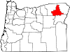 | |
| Unincorporated communities | ||
| Indian reservation | ||
| Ghost town | ||
| International | |
|---|---|
| National | |
| Geographic | |