
Sardis City, Alabama
Sardis City, Alabama | |
|---|---|
 Location in Etowah and Marshall counties, Alabama | |
| Coordinates: 34°10′26″N 86°7′17″W / 34.17389°N 86.12139°W | |
| Country | United States |
| State | Alabama |
| Counties | Etowah, Marshall |
| Area | |
| • Total | 7.88 sq mi (20.41 km2) |
| • Land | 7.86 sq mi (20.37 km2) |
| • Water | 0.02 sq mi (0.04 km2) |
| Elevation | 1,066 ft (325 m) |
| Population | |
| • Total | 1,814 |
| • Density | 230.67/sq mi (89.06/km2) |
| Time zone | UTC-6 (Central (CST)) |
| • Summer (DST) | UTC-5 (CDT) |
| ZIP code | 35956 |
| Area code | 256 |
| FIPS code | 01-68280 |
| GNIS feature ID | 2407291[2] |
Sardis City is a town in Etowah and Marshall counties in the U.S. state of Alabama. It is part of the Gadsden Metropolitan Statistical Area. It originally incorporated in May 1963 under the name of "Sardis".[4] It became Sardis City in the 1980s. At the 2020 census, the population was 1,814.[3]
Geography[edit]
Sardis City is located in northern Etowah County at 34°10′26″N 86°7′17″W / 34.17389°N 86.12139°W (34.173967, -86.121319).[5] A very small section of the town extends north into Marshall County. The town is bordered to the north by the city of Boaz. U.S. Route 431 passes through the west side of the town, leading northwest through Boaz 8 miles (13 km) to Albertville and southeast 17 miles (27 km) to Gadsden, the Etowah county seat.
According to the U.S. Census Bureau, Sardis City has a total area of 7.9 square miles (20.4 km2), of which 0.015 square miles (0.04 km2), or 0.20%, are water.[1] The town sits at 1,080 feet (330 m) above sea level atop the plateau of Sand Mountain. The town drains east to Short Creek, a north-flowing tributary of the Tennessee River. The Tennessee Valley Divide passes just west of the town limits.
Demographics[edit]
| Census | Pop. | Note | %± |
|---|---|---|---|
| 1970 | 368 | — | |
| 1980 | 883 | 139.9% | |
| 1990 | 1,301 | 47.3% | |
| 2000 | 1,438 | 10.5% | |
| 2010 | 1,704 | 18.5% | |
| 2020 | 1,814 | 6.5% | |
| U.S. Decennial Census[6] | |||
2000 census[edit]
At the 2000 census there were 1,438 people, 572 households, and 458 families living in the town. The population density was 195.1 inhabitants per square mile (75.3/km2). There were 597 housing units at an average density of 81.0 units per square mile (31.3 units/km2). The racial makeup of the town was 99.10% White, 0.14% Black or African American, 0.07% Native American, 0.14% Pacific Islander, and 0.56% from two or more races. 0.63% of the population were Hispanic or Latino of any race.[7] Of the 572 households 32.2% had children under the age of 18 living with them, 68.7% were married couples living together, 8.4% had a female householder with no husband present, and 19.9% were non-families. 18.5% of households were one person and 9.6% were one person aged 65 or older. The average household size was 2.51 and the average family size was 2.82.
The age distribution was 22.2% under the age of 18, 9.3% from 18 to 24, 28.4% from 25 to 44, 26.1% from 45 to 64, and 14.0% 65 or older. The median age was 38 years. For every 100 females, there were 100.0 males. For every 100 females age 18 and over, there were 94.6 males.
The median household income was $36,000 and the median family income was $44,063. Males had a median income of $31,875 versus $21,711 for females. The per capita income for the town was $18,411. About 7.4% of families and 10.0% of the population were below the poverty line, including 11.9% of those under age 18 and 10.7% of those age 65 or over.
2010 census[edit]
At the 2010 census there were 1,704 people, 657 households, and 509 families living in the town. The population density was 220 people per square mile (85 people/km2). There were 703 housing units at an average density of 89.0 units per square mile (34.4 units/km2). The racial makeup of the town was 98.2% White, 0.4% Black or African American, 0.1% Native American, 0.0% Pacific Islander, and 0.6% from two or more races. 0.7% of the population were Hispanic or Latino of any race.[8] Of the 657 households 31.2% had children under the age of 18 living with them, 63.0% were married couples living together, 10.2% had a female householder with no husband present, and 22.5% were non-families. 18.5% of households were one person and 10.5% were one person aged 65 or older. The average household size was 2.59 and the average family size was 2.97.
The age distribution was 24.4% under the age of 18, 6.8% from 18 to 24, 24.6% from 25 to 44, 28.1% from 45 to 64, and 16.1% 65 or older. The median age was 40.9 years. For every 100 females, there were 92.5 males. For every 100 females age 18 and over, there were 93.3 males.
The median household income was $45,714 and the median family income was $59,352. Males had a median income of $44,091 versus $28,333 for females. The per capita income for the town was $22,767. About 6.2% of families and 11.4% of the population were below the poverty line, including 8.9% of those under age 18 and 33.5% of those age 65 or over.
2020 census[edit]
| Race | Num. | Perc. |
|---|---|---|
| White (non-Hispanic) | 1,666 | 91.84% |
| Black or African American (non-Hispanic) | 3 | 0.17% |
| Native American | 1 | 0.06% |
| Asian | 8 | 0.44% |
| Other/Mixed | 63 | 3.47% |
| Hispanic or Latino | 73 | 4.02% |
As of the 2020 United States census, there were 1,814 people, 686 households, and 481 families residing in the town.
References[edit]
- ^ a b "2021 U.S. Gazetteer Files". United States Census Bureau. Retrieved April 15, 2022.
- ^ a b U.S. Geological Survey Geographic Names Information System: Sardis City, Alabama
- ^ a b "Sardis City town, Alabama: 2020 DEC Redistricting Data (PL 94-171)". U.S. Census Bureau. Retrieved April 15, 2022.
- ^ "Sardis City".
- ^ "US Gazetteer files: 2010, 2000, and 1990". United States Census Bureau. February 12, 2011. Retrieved April 23, 2011.
- ^ "U.S. Decennial Census". Census.gov. Retrieved June 6, 2013.
- ^ "U.S. Census website". United States Census Bureau. Retrieved January 31, 2008.
- ^ "U.S. Census website". United States Census Bureau. Retrieved July 23, 2015.
- ^ "Explore Census Data". data.census.gov. Retrieved December 11, 2021.
External links[edit]
Municipalities and communities of Etowah County, Alabama, United States | ||
|---|---|---|
| Cities |  | |
| Towns | ||
| CDPs | ||
| Unincorporated communities | ||
| Former City | ||
| Footnotes | ‡This populated place also has portions in an adjacent county or counties | |
Municipalities and communities of Marshall County, Alabama, United States | ||
|---|---|---|
| Cities | 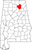 | |
| Towns | ||
| CDPs | ||
| Unincorporated communities | ||
| Ghost town | ||
| Footnotes | ‡This populated place also has portions in an adjacent county or counties | |
| International | |
|---|---|
| National | |