
Ashton Canal
| Ashton Canal | |
|---|---|
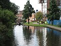
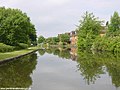
 The Ashton Canal at Droylsden | |
| Specifications | |
| Length | 6 miles (9.7 km) |
| Maximum boat length | 70 ft 0 in (21.34 m) |
| Maximum boat beam | 7 ft 0 in (2.13 m) |
| Locks | 18 |
| Status | Navigable |
| Navigation authority | Canal & River Trust |
| History | |
| Principal engineer | Benjamin Outram |
| Date of act | 1792 |
| Date of first use | 1796 |
| Date completed | 1797 |
| Date closed | 1961 |
| Date restored | 1974 |
| Geography | |
| Start point | Ashton-under-Lyne |
| End point | Ducie St Jn, Manchester |
| Branch(es) | Hollinwood Branch Canal, Stockport Branch, Islington Branch Canal |
| Connects to | Huddersfield Narrow Canal, Peak Forest Canal, Rochdale Canal |
Ashton Canal | |||||||||||||||||||||||||||||||||||||||||||||||||||||||||||||||||||||||||||||||||||||||||||||||||||||||||||||||||||||||||||||||||||||||||||||||||||||||||||||||||||||||||||||||||||||||||||||||||||||||||||||||||||||||||||||||||||||||
|---|---|---|---|---|---|---|---|---|---|---|---|---|---|---|---|---|---|---|---|---|---|---|---|---|---|---|---|---|---|---|---|---|---|---|---|---|---|---|---|---|---|---|---|---|---|---|---|---|---|---|---|---|---|---|---|---|---|---|---|---|---|---|---|---|---|---|---|---|---|---|---|---|---|---|---|---|---|---|---|---|---|---|---|---|---|---|---|---|---|---|---|---|---|---|---|---|---|---|---|---|---|---|---|---|---|---|---|---|---|---|---|---|---|---|---|---|---|---|---|---|---|---|---|---|---|---|---|---|---|---|---|---|---|---|---|---|---|---|---|---|---|---|---|---|---|---|---|---|---|---|---|---|---|---|---|---|---|---|---|---|---|---|---|---|---|---|---|---|---|---|---|---|---|---|---|---|---|---|---|---|---|---|---|---|---|---|---|---|---|---|---|---|---|---|---|---|---|---|---|---|---|---|---|---|---|---|---|---|---|---|---|---|---|---|---|---|---|---|---|---|---|---|---|---|---|---|---|---|---|---|---|
| |||||||||||||||||||||||||||||||||||||||||||||||||||||||||||||||||||||||||||||||||||||||||||||||||||||||||||||||||||||||||||||||||||||||||||||||||||||||||||||||||||||||||||||||||||||||||||||||||||||||||||||||||||||||||||||||||||||||
The Ashton Canal is a canal in Greater Manchester, England, linking Manchester with Ashton-under-Lyne.
Route[edit]

The Ashton leaves the Rochdale Canal at Ducie St. Junction in central Manchester, and climbs for 6 miles (9.7 km) through 18 locks,[1] passing through Ancoats, Holt Town, Bradford, Clayton, Openshaw, Droylsden, Fairfield and Audenshaw to make a head-on junction with the Huddersfield Narrow Canal (formerly the Huddersfield Canal) at Whitelands Basin in the centre of Ashton-under-Lyne. At Bradford, the canal passes very close to the City of Manchester Stadium (currently known as the Etihad Stadium for sponsorship reasons), which was originally built to host the 2002 Commonwealth Games.
Apart from the Rochdale and Huddersfield Narrow canals, the Ashton Canal only currently connects with one other canal. Just short of Whitelands, at Dukinfield Junction/Portland Basin a short arm crosses the river Tame on the Tame Aqueduct, and makes a head-on junction with the Peak Forest Canal.[2]
There used to be four other important connections to branch canals: the Islington Branch Canal in Ancoats; the Stockport Branch Canal from Clayton to Stockport (Heaton Norris); the Hollinwood Branch Canal from Fairfield to Hollinwood; and the Fairbottom Branch Canal (itself a branch of the Hollinwood Branch Canal) from Waterhouses to Fairbottom. There was to have been a fifth branch, namely the Beat Bank Branch Canal (itself a branch of Stockport Branch Canal) from Reddish to Beat Bank in Denton, but this was abandoned before completion.
Many of the canal locks are now listed buildings.[3]
History[edit]
| Manchester and Oldham Canal Act 1792 | |
|---|---|
| Act of Parliament | |
 | |
| Long title | An Act for making a Navigable Canal from Manchester, to or near Ashton-under-Lyne and Oldham, in the County Palatine of Lancaster. |
| Citation | 32 Geo. 3. c. 84 |
| Dates | |
| Royal assent | 11 June 1792 |
The canal received its Act of Parliament (32 Geo. 3. c. 84) in 1792. It was built to supply coal from Oldham and Ashton under Lyne to Manchester.[4] The first section between Ancoats Lane to Ashton-under-Lyne and Hollinwood was completed in 1796, followed by the lines to Heaton Norris and Fairbottom in 1797. Although there were plans to link it to the Rochdale Canal, it opened as an isolated waterway.
Benjamin Outram was retained to complete the final section between Ancoats Lane and the Rochdale Canal including the Piccadilly Basin. It included the unique Store Street Aqueduct, built on a 45 degree skew and believed to be the first major such structure in Britain and the oldest still in use today.
The section was completed by 1798, but the necessary extension by the Rochdale proprietors to the Bridgewater Canal was not built until 1800. Although the Huddersfield Narrow Canal was open as far as Woolroad by 1798, neither it, nor the Peak Forest Canal were complete. In fact it was another ten years before the former connected to Yorkshire and the east coast.
With little but local trade in its early years, the canal struggled financially and a dividend was not paid until 1806.
It then prospered until competition from railways, and later road transport, greatly diminished traffic, and through traffic had ended by 1945. Traffic on the branches ended in the 1930s. Following nationalisation in 1947–48, traffic did not revive, and all traffic had ceased by 1958, after which maintenance was run down. By 1961, combined with vandalism, the canal had become unnavigable, and its retention for pleasure use seemed unlikely.
The Ashton Canal was one of seven stretches of canal, formerly designated as remainder waterways, that were re-classified by the British Waterways Act 1983 of 8 February 1983. Under the act, a total of 82 miles (132 km) of canal were upgraded to Cruising Waterway Standard.[5]
In October 2021, lock numbers 13 and 15 were one of 142 sites across England to receive part of a £35-million injection into the government's Culture Recovery Fund.[6]
Leisure use[edit]
Pressure from the Inland Waterways Association, combined with the formation of the Peak Forest Canal Society, led to a campaign to reopen the Ashton, with the major organised volunteer clearance of the section though Droylsden in September 1968, known as Operation Ashton. Further campaigning, and the growth of local authority support, led to its restoration, along with the adjacent lower Peak Forest Canal, and reopening on 1 April 1974.[1]
The restoration of these two canals opened up the Cheshire Ring, an immediately (and still) popular one-week leisure cruise circling much of east Cheshire. With the opening of the Southern Pennine canals, the Ashton is now also part of the South Pennine Ring (Rochdale and Huddersfield Narrow) and the longest Pennine Ring of all (Outer Pennine Ring - Leeds & Liverpool and Huddersfield Narrow).
It used to be common to hear reports of unfortunate incidents along the Ashton, such as thefts from boats and intimidating, or at least unnerving, behaviour on the part of some local youths and children. This, for a time, caused boats to go through in convoys.[7][8][9] Today the Ashton Canal is increasingly valued by the communities through which it passes, and although many boaters still advise others to cover the Ashton during early hours, and not in school holidays, reports of problems often turn out to be the repeated telling of old stories. However, incidents do still occur, as in August 2014 when a number of boats were attacked by hooded youths.[10]
The locks are renowned for debris (shopping trolleys, wheely bins, rocks etc.) which can result in blocked lock gates, but Canal & River Trust workers are soon on site to clear any reported incidents. Portland Basin is a good overnight mooring after ascending the Ashton locks, for those who do not wish to proceed beyond Romiley.
There are current campaigns to restore the Hollinwood Branch and Stockport Branches.
Listed structures[edit]
The following structures along the canal are Grade II listed:[11]
- Locks numbers 1-3, 6-15 & 18
- Bridges numbers 4, 5, 9 & 16
- Lock Keepers Cottages at locks numbers 2 & 7
- Towpath Bridge over junction with Islington Branch Canal
- Towpath Bridge over junction with Stockport Branch Canal
- Former Packet Boathouse adjacent to bridge number 16
- Former Tollhouse adjacent to lock number 18 (Fairfield Top Lock)
- Mill Building on south bank east of Hope Works
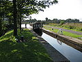
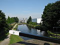
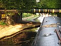
Image gallery[edit]
-
 Ancoats Bottom Lock (Lock 1)
 -
 Chips, New Islington and Lock 2 on the Ashton Canal
 -
 Beswick Locks (Locks 4 and 5)
 -
 Beswick Top Lock (Lock 7)
 -
 Narrowboat in Clayton Bottom Lock (Lock 8)
 -
 Lock 12
 -
 Yew Tree Swing Bridge
 -
 Lumb Lane Bridge (Bridge 21)
 -
 The Ashton Canal at Audenshaw
 -
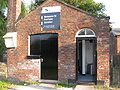 Canal & River Trust services at Fairfield Junction
 -
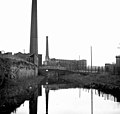 Ashton Canal at Ashton-under-Lyne in 1981


Points of interest[edit]
| Point | Coordinates (Links to map resources) |
OS Grid Ref | Notes |
|---|---|---|---|
| Dukinfield Junction | 53°28′57″N 2°05′59″W / 53.4824°N 2.0996°W | SJ934984 | Huddersfield Narrow Canal & Peak Forest Canal |
| Fairfield Lock 18 | 53°28′40″N 2°09′01″W / 53.4777°N 2.1503°W | SJ901978 | Stub of Hollinwood Branch Canal |
| Top of Clayton Locks (No.16) | 53°28′42″N 2°09′54″W / 53.4784°N 2.1650°W | SJ891979 | Flight of 9 locks |
| Jn with derelict Stockport Branch | 53°28′50″N 2°10′41″W / 53.4805°N 2.1780°W | SJ882982 | Clayton lock No.11 |
| Bottom of Clayton Locks (No.8) | 53°28′58″N 2°11′16″W / 53.4827°N 2.1879°W | SJ876984 | |
| Top of Beswick Locks (No.7) | 53°29′09″N 2°11′51″W / 53.4858°N 2.1974°W | SJ869988 | Flight of 4 locks |
| Bottom of Beswick Locks (No.4) | 53°29′07″N 2°12′16″W / 53.4854°N 2.2045°W | SJ865987 | |
| Top of Ancoats Locks (No.3) | 53°28′53″N 2°13′13″W / 53.4814°N 2.2203°W | SJ854983 | Flight of 3 locks |
| Ducie Street Junction | 53°28′48″N 2°13′49″W / 53.4799°N 2.2303°W | SJ848981 | Jn with Rochdale Canal |
See also[edit]
Bibliography[edit]
- Cumberlidge, Jane (2009). Inland Waterways of Great Britain (8th Ed.). Imray Laurie Norie and Wilson. ISBN 978-1-84623-010-3.
- Dean, Richard (2001). Historical Map 3:Canals of Manchester. M & M Baldwin. ISBN 0-947712-43-7.
- Edwards, Lewis A. (1985). Inland Waterways of Great Britain (6th ed.). Imray Laurie Norie and Wilson. ISBN 0-85288-081-2.
- Keaveney, E.; Brown, D. L. (1974). The Ashton Canal: A History Of The Manchester To Ashton-under-Lyne Canal.
- Schofield, Reginald B. (2000). Benjamin Outram. Cardiff: Merton Priory Press. ISBN 978-1-898937-42-5.
References[edit]
- ^ a b Cumberlidge 2009, pp. 61–62
- ^ Dean 2001
- ^ "Listed Buildings in Manchester". Manchester UK. Archived from the original on 5 June 2011. Retrieved 22 June 2011.
- ^ Ashton Canal, Engineering Timelines, archived from the original on 19 May 2012, retrieved 11 December 2011
- ^ Edwards 1985, p. 33
- ^ "Heritage and Craft Workers Across England Given a Helping Hand" – Historic England, 22 October 2021
- ^ "Cops Ahoy in new canal cruiser". Manchester Evening News. 13 July 1996.
- ^ "Bicentenary of Ashton Canal may help to return it to its former glory". Manchester Evening News. 17 March 1997.
- ^ "Pirates ahoy on urban waterway". Manchester Evening News. 2 November 2004. Retrieved 23 October 2006.
- ^ "Boats attacked in wrecking spree". Narrowboat World. 10 August 2014. Retrieved 11 August 2014.
- ^ Good Stuff IT Services. "Search: +Ashton +Canal - British Listed Buildings". British Listed Buildings.
External links[edit]
![]() Media related to Ashton Canal at Wikimedia Commons
Media related to Ashton Canal at Wikimedia Commons